Azimuth

An example is the position of a star in the sky. The star is the point of interest, the reference plane is the horizon or the surface of the sea, and the reference vector points north. The azimuth is the angle between the north vector and the perpendicular projection of the star down onto the horizon.[1]
Azimuth is usually measured in degrees (°). The concept is used in navigation, astronomy, engineering, mapping, mining and artillery.
Contents
In land navigation, azimuth is usually denoted alpha,
 , and defined as a horizontal angle measured clockwise from a north base line or meridian.[2][3] Azimuth
has also been more generally defined as a horizontal angle measured
clockwise from any fixed reference plane or easily established base
direction line.[4][5][6]
, and defined as a horizontal angle measured clockwise from a north base line or meridian.[2][3] Azimuth
has also been more generally defined as a horizontal angle measured
clockwise from any fixed reference plane or easily established base
direction line.[4][5][6]Today the reference plane for an azimuth is typically true north, measured as a 0° azimuth, though other angular units (grad, mil) can be used. Moving clockwise on a 360 degree circle, east has azimuth 90°, south 180°, and west 270°. There are exceptions: some navigation systems use south as the reference plane. Any direction can be the plane of reference, as long as it is clearly defined.
Quite commonly, azimuths or compass bearings are stated in a system in which either north or south can be the zero, and the angle may be measured clockwise or anticlockwise from the zero. For example, a bearing might be described as "(from) south, (turn) thirty degrees (toward the) east" (the words in brackets are usually omitted), abbreviated "S30°E", which is the bearing 30 degrees in the eastward direction from south, i.e. the bearing 150 degrees clockwise from north. The reference direction, stated first, is always north or south, and the turning direction, stated last, is east or west. The directions are chosen so that the angle, stated between them, is positive, between zero and 90 degrees. If the bearing happens to be exactly in the direction of one of the cardinal points, a different notation, e.g. "due east", is used instead.
True north-based azimuths
| From North | |||
|---|---|---|---|
| North | 0° or 360° | South | 180° |
| North-Northeast | 22.5° | South-Southwest | 202.5° |
| Northeast | 45° | Southwest | 225° |
| East-Northeast | 67.5° | West-Southwest | 247.5° |
| East | 90° | West | 270° |
| East-Southeast | 112.5° | West-Northwest | 292.5° |
| Southeast | 135° | Northwest | 315° |
| South-Southeast | 157.5° | North-Northwest | 337.5° |
Calculating azimuth
We are standing at latitude , longitude zero; we want to find the azimuth from our viewpoint to Point 2 at latitude
  , longitude L (positive eastward). We can get a fair approximation by assuming the Earth is a sphere, in which case the azimuth is given by
Various websites will calculate geodetic azimuth – e.g. GeoScience Australia site. Formulas for calculating geodetic azimuth are linked in the distance article.
Normal-section azimuth is simpler to calculate; Bomford says Cunningham's formula is exact for any distance. If
 is the flattening for the chosen spheroid (e.g. 1/298.257223563 for WGS84) then
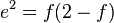


If
= 0 then
To calculate the azimuth of the sun or a star given its declination and hour angle at our location, we modify the formula for a spherical earth. Replace
with declination and longitude difference with hour angle, and change
the sign (since hour angle is positive westward instead of east).Mapping

Astronomy
Used in celestial navigation, an azimuth is the direction of a celestial body from the observer.[7] In astronomy, an azimuth is sometimes referred to as a bearing. In modern astronomy azimuth is nearly always measured from the north. (The article on coordinate systems, for example, uses a convention measuring from the south.) In former times, it was common to refer to azimuth from the south, as it was then zero at the same time that the hour angle of a star was zero. This assumes, however, that the star (upper) culminates in the south, which is only true if the star's declination is less than (i.e. further south than) the observer's latitude.Other systems
Right ascension
If instead of measuring from and along the horizon the angles are measured from and along the celestial equator, the angles are called right ascension if referenced to the Vernal Equinox, or hour angle if referenced to the celestial meridian.Horizontal coordinate
In the horizontal coordinate system, used in celestial navigation and satellite dish installation, azimuth is one of the two coordinates. The other is altitude, sometimes called elevation above the horizon. See also: Sat finder.Polar coordinate
In mathematics the azimuth angle of a point in cylindrical coordinates or spherical coordinates is the anticlockwise angle between the positive x-axis and the projection of the vector onto the xy-plane. The angle is the same as an angle in polar coordinates of the component of the vector in the xy-plane and is normally measured in radians rather than degrees. As well as measuring the angle differently, in mathematical applications theta, , is very often used to represent the azimuth rather than the symbol phi
  .
.Other uses of the word
For magnetic tape drives, azimuth refers to the angle between the tape head(s) and tape.In sound localization experiments and literature, the azimuth refers to the angle the sound source makes compared to the imaginary straight line that is drawn from within the head through the area between the eyes.
An azimuth thruster in shipbuilding is a propeller that can be rotated horizontally.


0 komentar:
Posting Komentar